Afternoon everyone, the risk area from this morning’s discussion has not changed. All of the metro area is in a slight risk for tonight, but I think the threat for a few more storms with damaging winds and a chance for an isolated tornado has increased a slight bit. Here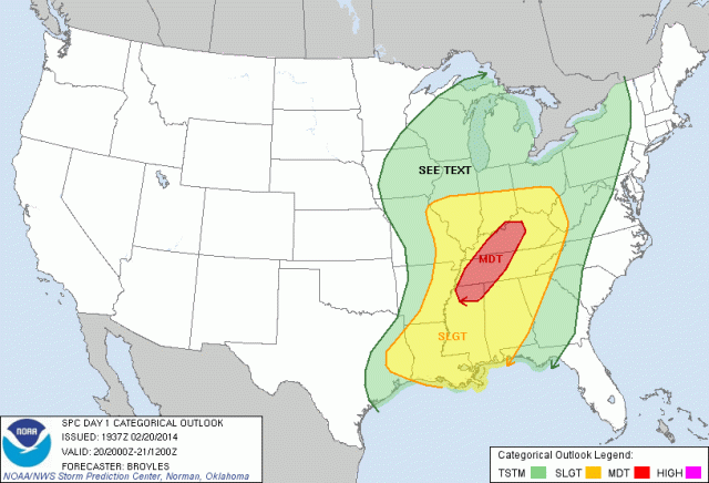
the risk area for later tonight. As of 4:20 EST there have only been one tornado warning and that was for parts of IL, you can actually see the strongest part of the jet stream on water vapor moving through that part of the country, that is where the most intense upper energy is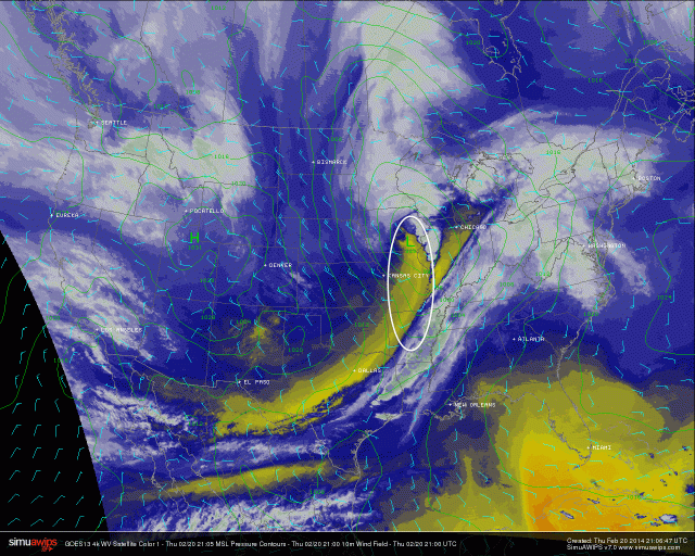
however, there is a bottom of the part of the jet that has just as much upward velocities that will be moving just to the north of N Georgia by around 2-6am. Here is the NAM that shows that jet and I have highlighted that part of the jet that is the other area with strong  upper forcing. This is for 7am so it will be moving right overhead at the timeframe of 2-6am… This is the time that I think most of the area will have the best chance of seeing severe weather. We also have that small tongue of instability that will be coming in at the same time, here is the sequence from 2-4am.
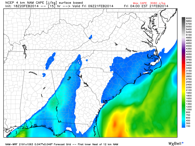
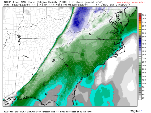
Anything that is getting into the green shade of things for us, at that time of night, leads to a bit of concern. Also the atmospheric spin, what we weather geeks call helicity, will be pretty high ahead of the cold front. It usually takes 200 units of helicity or greater to have a tornado threat and we are pushing 300 plus from 2-6am. Take a look at the maps of helicity below and you can see the white and light purple inside the shaded area of green.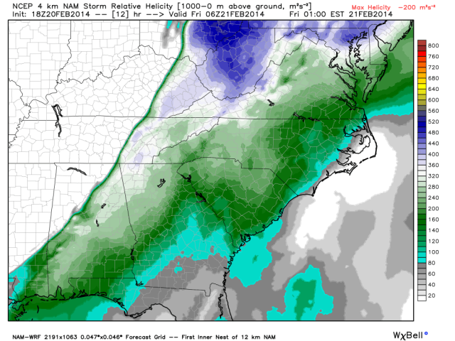
The timing from earlier blogs is pretty much the same. We are talking about this line moving into the NW section of the state around 1am and making it to the Atlanta metro area by around 4-5am. Here is the latest projections from the WRF model.


The threat as the line moves through will definitely be straight line winds as I expect quite a few severe thunderstorm warnings with this line later tonight. There is that chance along the line that there could be a very quick tornado spin up occur. Again, we are talking about a purely linear storm complex moving through with intense lightning, some damaging winds, flooding rain, and some hail so don’t focus on the slight threat of a brief spin up.
Regardless I will be up all night tracking the storms right here, on my fb page, and twitter which you can see below so make sure you follow me. Also you can look on the top left had side and click follow to receive an email every time I put out a new blog.
Share this to your friends on Facebook so they know about it and I can’t tell you how much I appreciate all of you reading the blog!
On a scale of 1-10 I am going with a 4 on this one for the threat for damaging winds and a very slim chance of a brief spinup.
Thanks again for supporting the blog and my social media presence!!
Here is a link to my facebook page http://www.facebook.com/thechiefmikefrancis
and my twitter feed http://www.twitter.com/mikefranciswx

As a map geek, I appreciate all the maps! It is great to be able to easily pull up your blog to show a weather map to my class too! Thanks!
Thanks Kari!! Yeah, I am a total map geek LOL!
Thanks for your hard work and you are the first place I go to for info on weather.
Thanks a ton!!